oleh admin | Mar 28, 2025 | climate, meteorology, news, rainfall, weather forecasts
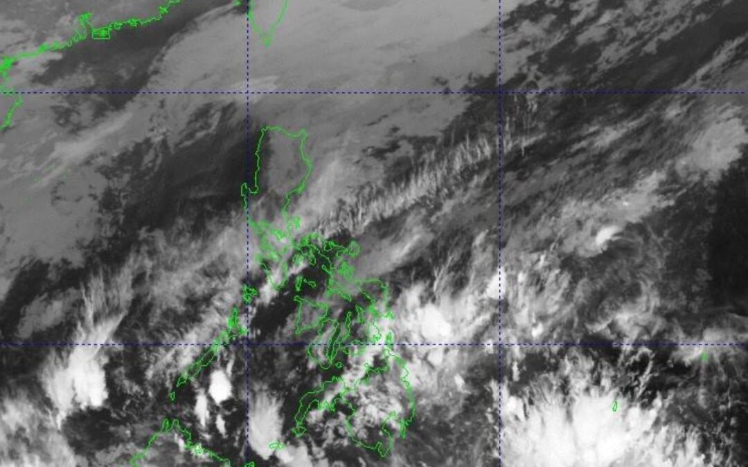
The state weather bureau reported on Tuesday that Metro Manila and the entire nation will encounter the easterly winds, which originate from the eastern regions and traverse the Pacific Ocean, bringing along warm and moist conditions, within the next 24 hours.
Chenel Dominguez, a weather forecaster from the Philippine Atmospheric Geophysical and Astronomical Services Administration (PAGASA), stated that they have yet to detect any tropical storms within the country’s jurisdiction. She also mentioned that there is no anticipation for disturbances likely to develop into typhoons over the next few days.
At the same time, she mentioned that the northeast monsoon, commonly referred to as ‘amihan,’ is gradually losing strength. It now impacts primarily the Ilocos Region, Cordillera Administrative Region, and Cagayan Valley, with sporadic light showers expected in these areas.
The winds from the east have been dominant in numerous regions across the nation such as the Bicol Region, Western Visayas, Northern Samar, Eastern Samar, Samar, Romblon, and Palawan, as reported by the national meteorological office.
The other weather system — known as the Intertropical Convergence Zone (ITCZ), which is essentially an invisible band where northerly and southerly winds converge — will bring intermittent rain showers and thunderstorms to both the Davao Region and the Zamboanga Peninsula.
This would also impact SOCCSKSARGEN (which includes South Cotabato, Cotabato, Sultan Kudarat, Sarangani, and General Santos) as well as BARMM (the Bangsamoro Autonomous Region in Muslim Mindanao), with widespread cloud cover expected according to Pagasa’s 5:00 a.m. bulletin.
oleh admin | Mar 24, 2025 | climate, meteorology, rain, vietnam, weather forecasts
This year, Vietnam can expect more moderate weather conditions, featuring hotter periods that will arrive later than typical along with above-average precipitation, as stated by the meteorological service.
The National Center for Hydro-Meteorological Forecasting has stated that from April through June, the ENSO climate event—known as the El Niño–Southern Oscillation, characterized by abnormally high sea surface temperatures in the central and eastern parts of the Pacific Ocean—is anticipated to remain neutral with a likelihood of 70-80%, affecting weather conditions across Vietnam.
Cold air waves will gradually weaken. Heatwaves in the northern and central regions will arrive later and be less intense than in previous years.
The temperatures in these regions are anticipated to rise starting from May.
|
|
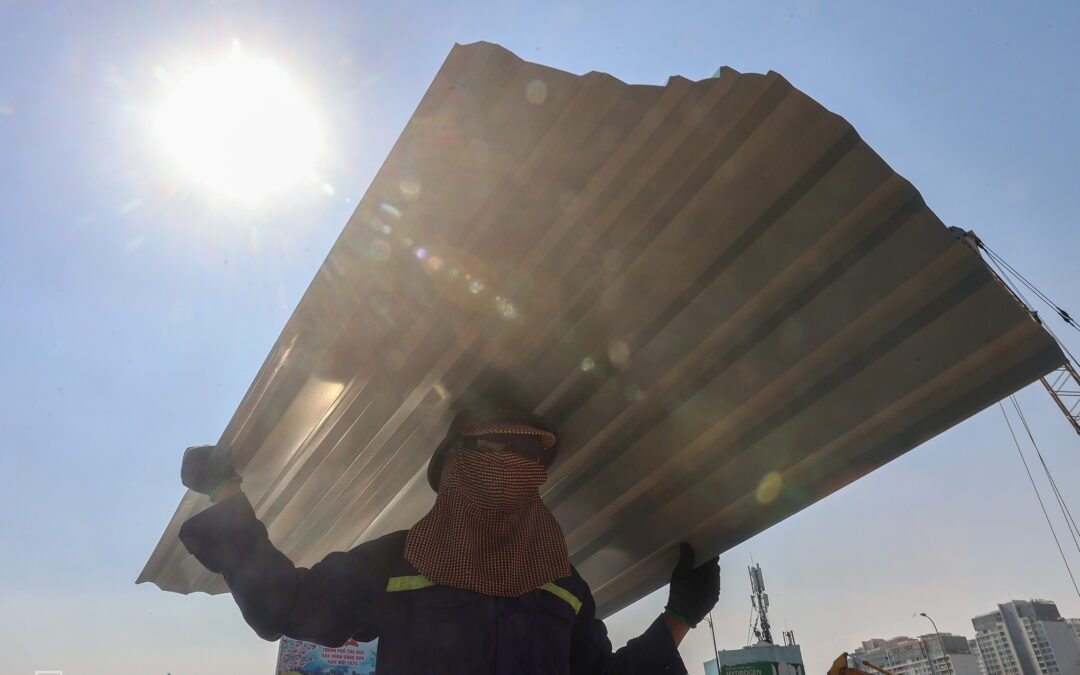
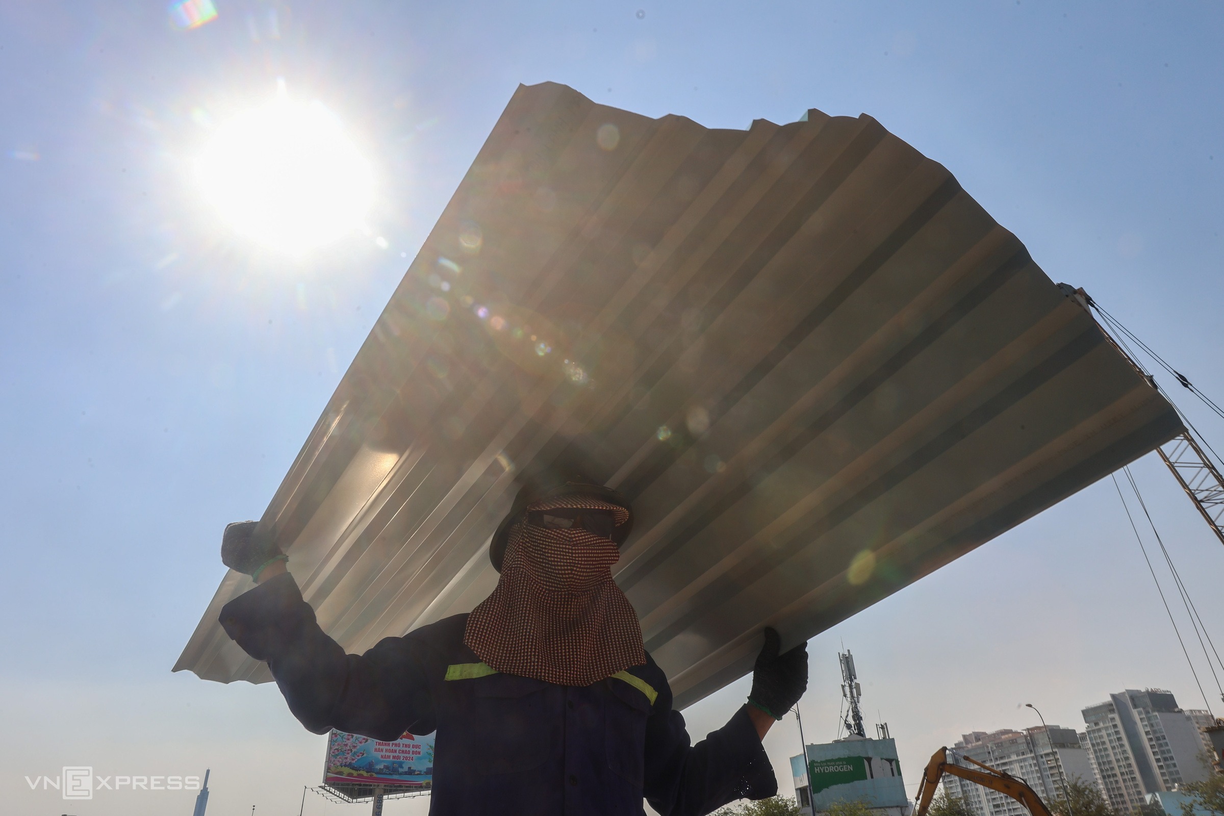
A construction worker braving the intense heat in Ho Chi Minh City on April 9, 2024, as the temperature climbed above 40 degrees Celsius. Photo by VnExpress/Quynh Tran
|
In the Central Highlands and southern regions, heatwaves are forecast to begin later than usual in April bringing fewer days of extreme heat.
Generally, temperature levels throughout the nation will remain near their historical norms, with the exception of the northwestern region, where they could increase by 0.5-1 degrees Celsius higher than usual during May.
Even with the more favorable forecast, northern and central Vietnam will likely face extended periods of elevated heat during July and August, with conditions slowly improving as we move into September.
The wet season starting in April will result in substantial rainfall across the northern areas, north-central zones, Central Highlands, and southern parts of the region, with especially intense showers predicted for May and June.
It is anticipated that in the northern region, precipitation will be typical in April with amounts ranging from 70-120 mm in the flatlands and over 150 mm in the mountains.
In May, we can expect a rise in precipitation of around 5-10%.
In June, rainfall is expected to reach 250 mm, with certain elevated regions potentially getting up to 500 mm.
In the central area, precipitation in April should remain near average but might rise by 5-15% in May, totaling around 200 millimeters.
In the Central Highlands and southern areas, precipitation levels are expected to range from 5-15% higher than average during April and May.
From July through September, six storms are predicted to form over the East Sea, with three of them possibly reaching Vietnam’s shores.

|
|
Ha Long was left devastated following Typhoon Yagi in September 2024. Image courtesy of VnExpress/Giang Huy
|
In July and August, the northern region is expected to experience between 250-500 millimeters of rain. Precipitation levels for September should fall within the 150-250 millimeter range, consistent with typical amounts.
In the Central Highlands and southern regions, precipitation levels will range from 250 to 400 millimeters.
Vietnam endured
19 heatwaves last year
with temperatures surpassing long-term averages by 0.5-1.5 degrees Celsius.
On April 28, Dong Ha city in Vietnam’s central Quang Tri Province experienced a high of 44 degrees Celsius, marking the highest temperature observed in the month of April nationwide since 1976.
Last year, there were also 10 typhoons and one tropical depression recorded over the East Sea, out of which five made landfall.
Typhoon Yagi
was the most devastating, hitting Quang Nginh Province and Hai Phong City in the northern region with gusts of up to 166 km/h.
As Vietnam enters yet another uncertain year, officials caution that although severe heat might subside, the dangers posed by intense rainfall, storms, and floods continue to be significantly elevated.