
oleh admin | Apr 11, 2025 | disasters, meteorology, news, severe weather, storms
Multiple storms sweeping through the United States resulted in significant flooding and led to 16 fatalities, with one of those being a young child aged nine. The National Weather Service issued warnings about additional storms anticipated on Sunday.
Severe storms have battered the central-Eastern part of the United States, resulting in at least 16 fatalities, according to local authorities. This includes several children among the victims.
The National Weather Service (NWS) issued a warning stating that
further “severe” flash flooding
as anticipated in the upcoming days.
A number of fierce storms stretching from the states of Arkansas to Ohio damaged buildings, flooded roadways and produced dozens of tornadoes over the past week.
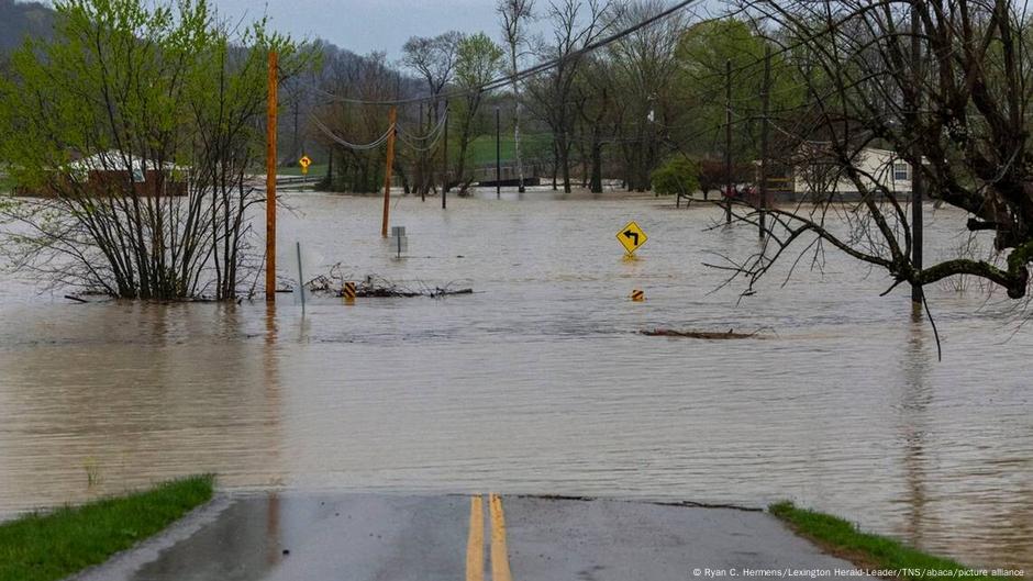
Tennessee suffered the most from severe weather conditions, with officials reporting on Saturday that 10 fatalities occurred throughout the western region of the state.
Two people were killed due to floods in Kentucky, according to state Governor Andy Beshear, including a nine-year-old child who was “swept away by floodwaters,” as he walked to a bus stop.
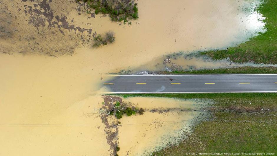
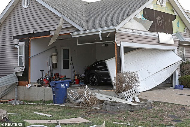
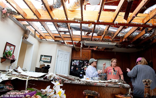
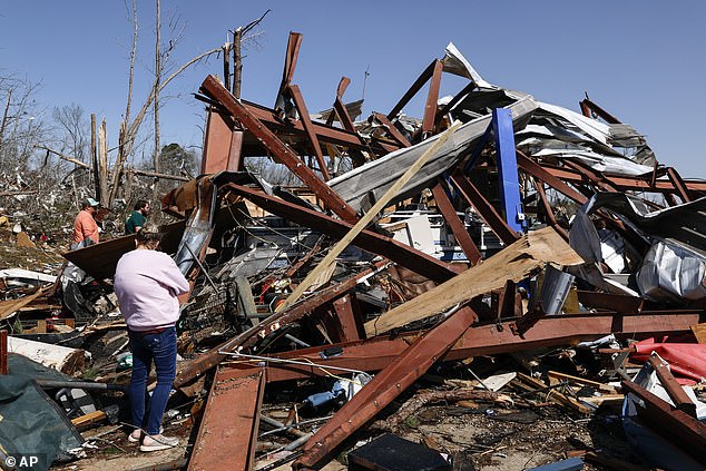
Images revealed extensive destruction caused by the storm throughout multiple states, featuring houses ripped apart, fallen trees, disrupted electrical wires, and flipped vehicles.
The NWS reported that severe and extensive flash flooding will continue through Sunday in portions of the central-eastern area, cautioning that “both lives and properties face significant peril.”
Two additional fatalities related to the storms were reported in Missouri and one in Indiana, as stated by local media outlets and officials.
A 5-year-old child was discovered deceased inside a residence in Little Rock, Arkansas, reportedly due to the continuing severe weather conditions, according to a statement from the state’s emergency management agency.
G flooding has hit unprecedented levels in numerous communities,” Governor Beshear of Kentucky posted on social media on Saturday, advising residents in the state to “stay off the roads and never attempt to drive through floodwater.
As of early Sunday, more than 100,000 individuals remained without electricity in Arkansas and Tennessee, reported the monitoring site PowerOutage US.
The National Weather Service cautioned that moderate to intense tornadoes might develop over areas of the Tennessee Valley and Lower Mississippi Valley on Sunday, alongside “severe thunderstorms.”
Edited by Jenipher Camino Gonzalez
Author: Kalika Mehta (with Reuters, AP)

oleh admin | Mar 30, 2025 | disasters, emergencies, news, severe weather, storms
A significant storm system is currently moving through the central U.S., bringing with it an array of hazardous weather conditions including intense thunderstorms, tornadoes, and ice storms. This has resulted in widespread power outages affecting hundreds of thousands of people and placing millions at risk of damage from these destructive forces.
Over 75 million Americans find themselves within the danger area as the enormous weather system moves eastwards, potentially setting off tornado watches, flash flood warnings, and ice storm alerts across several states.
‘A wide area spanning much of the Southeast along with parts of the lower and mid sections will likely experience multiple intense thunderstorms throughout today and into the night.’
Mississippi
Valley into the
Ohio
valleys and the southern Great Lakes region,’
NOAA’s Storm Prediction Center
announced Sunday.
The statement went on to say, ‘There is a high likelihood of extensive areas experiencing damaging winds. Additionally, significant-sized hail and multiple tornadoes are expected from supercell thunderstorms. Some of these tornadoes might be intense.’
About twelve tornadoes might strike cities such as Little Rock.
Arkansas
; Memphis and Nashville in Tennessee; Paducah,
Kentucky
; Evansville and Bloomington,
Indiana
as early as Sunday afternoon and evening.
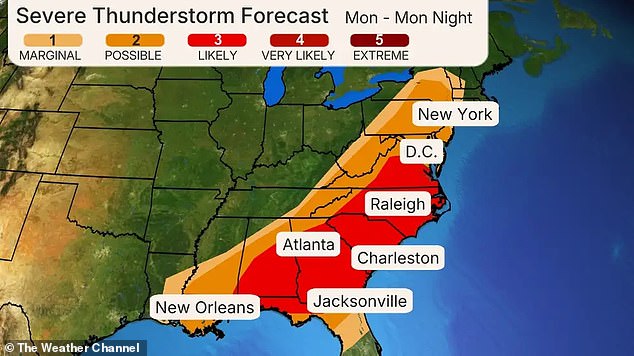
Severe weather forecasted for Monday is anticipated to impact the busy Interstate 81, 85, and 95 routes stretching from New Orleans to Atlanta, Charlotte, and Washington.
DC
, Philadelphia and
New York City
, as reported
Accuweather
.
By late Saturday evening, a tornado warning had been issued for large parts of the region.
Oklahoma
until 1 am Sunday,
ABC News
noted, since forecasters cautioned about ‘substantially sized hail along with destructive wind gusts’ throughout the southern Plains region.
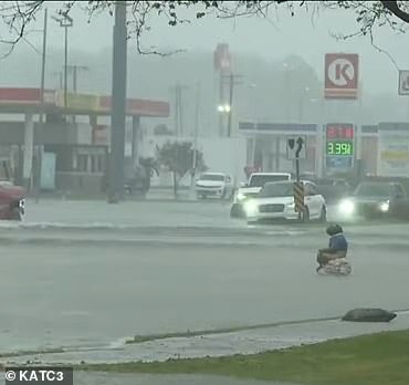
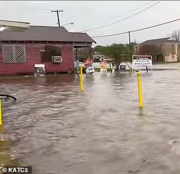
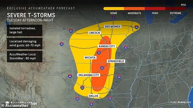
This might affect significant areas such as Oklahoma City and Dallas throughout the evening.
Southern
Louisiana
Near Baton Rouge was likewise subject to a flash flood warning, as certain regions had already received up to 4.5 inches of rainfall.
Meteorologists anticipate an additional 1 to 2 inches could occur by early Sunday.
Destruction has already started in sections of the Midwest, with over 200,000 customers experiencing power outages—67,631 in northern Wisconsin and an astounding 148,141 in northern Michigan.
Michigan
– Following a major ice storm that led to extensive tree destruction and complicated travel, according to TMJ4.
Local authorities indicate that several counties in northern Michigan are facing widespread power outages, impacting more than 90 percent of inhabitants, due to trees falling onto electrical wires.
On Sunday, the situation might worsen due to the storm moving eastwards, bringing about several waves of severe weather systems anticipated to move across eastern Texas up to the southern Great Lakes region during the daytime and extending through the nighttime hours.
This is where the highest likelihood of hazardous severe thunderstorms is anticipated.
Meteorologists have likewise alerted about a particularly hazardous area prone to intense tornadoes extending from eastern Arkansas into western regions.
Tennessee
and Kentucky into southwestern Indiana.
It might affect residents in Memphis, Nashville, Louisville, and Evansville.
In addition, thunderstorms accompanied by heavy rainfall are advancing towards the Carolinas and Asheville—areas that have recently experienced wildfires because of arid weather conditions.

On Saturday, seven states ranging from New York to North Carolina continued to face Increased Fire Risk.
Many regions will continue to face significant weather hazards throughout the night.
At the same time, the northern part of the storm is ushering in a cold front, with predictions of snow and ice stretching from North Dakota all the way to New England.
Warnings of an ice storm have been posted for Wisconsin and Michigan, with forecasts indicating that as much as a half-inch of ice could accumulate on roads, trees, and electrical systems.
By Monday, this damaging system will hit the East Coast and the I-95 corridor, possibly affecting zones ranging from Upstate New York to Tallahassee and New Orleans, bringing along hazardous winds and potential twisters in the southern parts.
Read more


