
by admin | Apr 2, 2025 | africa, climate, climate change, environmentalism, global warming
Addis Ababa, April 1, 2025 (ENA) — According to Jolly Wasambo, who serves as the coordinator of the AUC’s Intra-ACP Climate Services and Related Applications program, coordinated collective action across the continent is essential for addressing climate challenges in Africa.
As he states, many African nations are involved in climate initiatives centered around natural resources.
“In Ethiopia, they have initiated the Green Legacy program, which involves planting billions of trees… This green movement is crucial for addressing problems like land degradation due to desertification and enhancing carbon capture,” according to the coordinator.
He pointed out that other nations have their own programs too, suggesting, “Why don’t we unite as one continent and declare, ‘This initiative was launched in Ethiopia, this project was implemented in Tanzania, and this program succeeded in Burkina Faso?'”
Wasambo thinks that Africans ought to unite and strive for cooperation between countries, enabling them to exchange experiences; allowing them to adopt best practices as well, and subsequently support each other in this collective effort.
The coordinator additionally mentioned that the African Union has created the Great Green Wall Framework and Strategy.
The African Union has developed the Great Green Wall Framework and Strategy, which essentially aims to bring these nations together in the region, ensuring their commitment to moving forward with this initiative.
He explained that dependable and prompt climate data is essential for delivering accessible, current, and trustworthy information and services. This helps support socioeconomic growth at both national and continental levels.
Wasambo argued that the African Union Commission is ideally suited for coordinating these initiatives.
“When it comes to Africa, the AUC is the entity responsible for these initiatives, and they are actively involved across several sectors,” he stated, adding that the commission is particularly focused on uniting member states in forestry and sustainable management of the blue economy.
Moreover, the coordinator advocated for a cooperative strategy to build upon current programs and new ideas such as the Green Legacy initiative in Ethiopia and similar efforts.
Most importantly, as we proceed, we must also keep our eyes wide open. What other new initiatives and innovations are emerging?
Through the ClimSA initiative, he mentioned that the AUC is dedicated to improving the ability of member countries to produce and use accurate climate data.
To achieve this, we require accurate and up-to-date climate data for policymakers to make informed decisions, alongside enabling those who utilize such information to enhance their economic growth and overall wellbeing within their respective nations.
This initiative seeks to fill data gaps through the use of space technology and by offering infrastructure along with training to participating countries.
“We must enhance the capabilities of national meteorological and hydrological agencies since they generate weather and climate data, which all sectors can utilize,” Wasambo explained further.
The coordinator highlighted that the Integrated African Strategy for Meteorology, Weather, and Climate Services was approved in 2022.
The strategy serves as a roadmap for the continent, outlining how it can produce information.
Provided by Syndigate Media Inc. (
Syndigate.info
).
by admin | Mar 28, 2025 | climate, meteorology, news, rainfall, weather forecasts
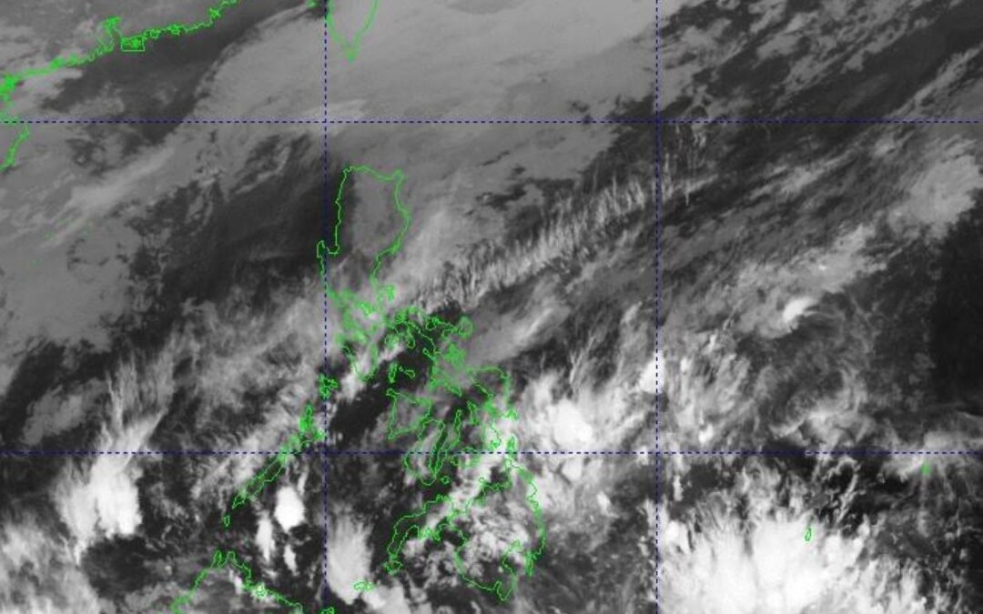
The state weather bureau reported on Tuesday that Metro Manila and the entire nation will encounter the easterly winds, which originate from the eastern regions and traverse the Pacific Ocean, bringing along warm and moist conditions, within the next 24 hours.
Chenel Dominguez, a weather forecaster from the Philippine Atmospheric Geophysical and Astronomical Services Administration (PAGASA), stated that they have yet to detect any tropical storms within the country’s jurisdiction. She also mentioned that there is no anticipation for disturbances likely to develop into typhoons over the next few days.
At the same time, she mentioned that the northeast monsoon, commonly referred to as ‘amihan,’ is gradually losing strength. It now impacts primarily the Ilocos Region, Cordillera Administrative Region, and Cagayan Valley, with sporadic light showers expected in these areas.
The winds from the east have been dominant in numerous regions across the nation such as the Bicol Region, Western Visayas, Northern Samar, Eastern Samar, Samar, Romblon, and Palawan, as reported by the national meteorological office.
The other weather system — known as the Intertropical Convergence Zone (ITCZ), which is essentially an invisible band where northerly and southerly winds converge — will bring intermittent rain showers and thunderstorms to both the Davao Region and the Zamboanga Peninsula.
This would also impact SOCCSKSARGEN (which includes South Cotabato, Cotabato, Sultan Kudarat, Sarangani, and General Santos) as well as BARMM (the Bangsamoro Autonomous Region in Muslim Mindanao), with widespread cloud cover expected according to Pagasa’s 5:00 a.m. bulletin.
by admin | Mar 24, 2025 | climate, meteorology, rain, vietnam, weather forecasts
This year, Vietnam can expect more moderate weather conditions, featuring hotter periods that will arrive later than typical along with above-average precipitation, as stated by the meteorological service.
The National Center for Hydro-Meteorological Forecasting has stated that from April through June, the ENSO climate event—known as the El Niño–Southern Oscillation, characterized by abnormally high sea surface temperatures in the central and eastern parts of the Pacific Ocean—is anticipated to remain neutral with a likelihood of 70-80%, affecting weather conditions across Vietnam.
Cold air waves will gradually weaken. Heatwaves in the northern and central regions will arrive later and be less intense than in previous years.
The temperatures in these regions are anticipated to rise starting from May.
|
|
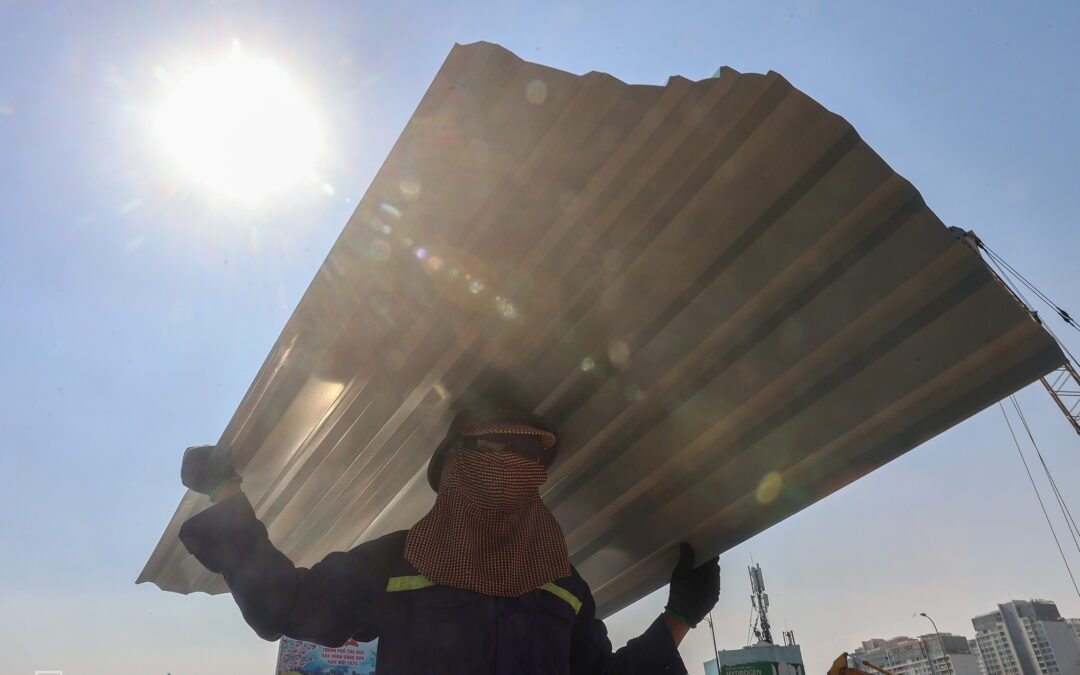
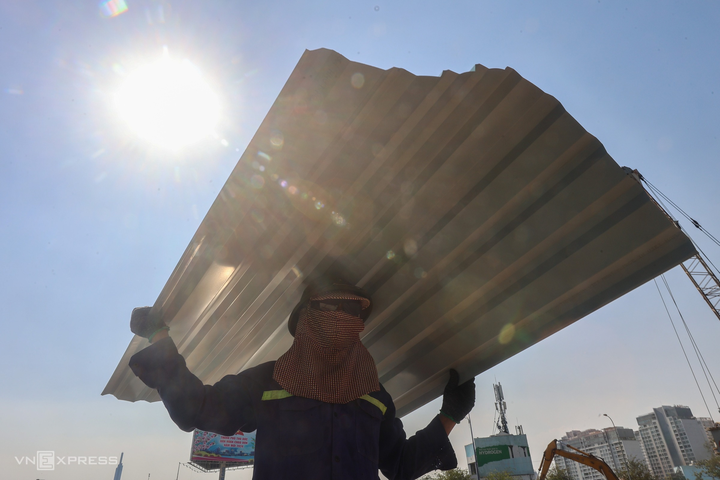
A construction worker braving the intense heat in Ho Chi Minh City on April 9, 2024, as the temperature climbed above 40 degrees Celsius. Photo by VnExpress/Quynh Tran
|
In the Central Highlands and southern regions, heatwaves are forecast to begin later than usual in April bringing fewer days of extreme heat.
Generally, temperature levels throughout the nation will remain near their historical norms, with the exception of the northwestern region, where they could increase by 0.5-1 degrees Celsius higher than usual during May.
Even with the more favorable forecast, northern and central Vietnam will likely face extended periods of elevated heat during July and August, with conditions slowly improving as we move into September.
The wet season starting in April will result in substantial rainfall across the northern areas, north-central zones, Central Highlands, and southern parts of the region, with especially intense showers predicted for May and June.
It is anticipated that in the northern region, precipitation will be typical in April with amounts ranging from 70-120 mm in the flatlands and over 150 mm in the mountains.
In May, we can expect a rise in precipitation of around 5-10%.
In June, rainfall is expected to reach 250 mm, with certain elevated regions potentially getting up to 500 mm.
In the central area, precipitation in April should remain near average but might rise by 5-15% in May, totaling around 200 millimeters.
In the Central Highlands and southern areas, precipitation levels are expected to range from 5-15% higher than average during April and May.
From July through September, six storms are predicted to form over the East Sea, with three of them possibly reaching Vietnam’s shores.

|
|
Ha Long was left devastated following Typhoon Yagi in September 2024. Image courtesy of VnExpress/Giang Huy
|
In July and August, the northern region is expected to experience between 250-500 millimeters of rain. Precipitation levels for September should fall within the 150-250 millimeter range, consistent with typical amounts.
In the Central Highlands and southern regions, precipitation levels will range from 250 to 400 millimeters.
Vietnam endured
19 heatwaves last year
with temperatures surpassing long-term averages by 0.5-1.5 degrees Celsius.
On April 28, Dong Ha city in Vietnam’s central Quang Tri Province experienced a high of 44 degrees Celsius, marking the highest temperature observed in the month of April nationwide since 1976.
Last year, there were also 10 typhoons and one tropical depression recorded over the East Sea, out of which five made landfall.
Typhoon Yagi
was the most devastating, hitting Quang Nginh Province and Hai Phong City in the northern region with gusts of up to 166 km/h.
As Vietnam enters yet another uncertain year, officials caution that although severe heat might subside, the dangers posed by intense rainfall, storms, and floods continue to be significantly elevated.

by admin | Mar 24, 2025 | climate, climate change, singapore, sustainability, temperature
In 2024, Singapore experienced an annual average temperature of 28.4 degrees Celsius, marking it as the hottest year ever recorded, equally matched with both 2019 and 2016, as reported by the country’s National Environment Agency.
The annual report issued by the agency on March 23 stated that each month of 2024 experienced temperatures that matched or exceeded their respective historical averages. Throughout the year, numerous temperature records were surpassed, including peak daily lows recorded in February and peak daily highs documented in December.
The past ten years from 2015 to 2024 marked the nation’s hottest decade ever recorded, with an average of 28.11 degrees Celsius. This figure was 0.05 degrees Celsius higher than the previous decade spanning 2014 to 2023, making it the fourth successive year that Singapore broke its own decadal mean temperature record.
The report highlighted that although climate change led to higher temperatures, climate variability in 2024 was also a significant factor.
The El Niño phenomenon that emerged in 2023 and concluded in the second quarter of 2024 probably played a role in the elevated temperatures observed in 2024. This includes the period of Singapore’s hottest months (March – May). That particular stretch ranked as the third warmest such season ever recorded, following closely behind 1998 and 2016—years characterized by intense El Niño conditions as well.
It has been observed that Singapore’s annual temperature pattern in 2024 mirrored the recent global trends as reported by the World Meteorological Organization. Consequently, 2024 was marked as the hottest year documented worldwide since 1850.

by admin | Mar 24, 2025 | africa, climate, climatology, environmental science, environmentalism
Research conducted on Lake Sebkha el Melah in Algeria associates the replenishment of old Sahara lakes with atmospheric patterns from Morocco, particularly storm systems originating over the Atlantic Ocean. This study emphasizes that intense rainfalls, not an overall rise in rainfall levels, primarily drive these refilling occurrences.
The Sahara Desert was not always as dry and barren as it is today. Experts suggest that in earlier times, it might have had more moisture and vegetation, including actual lake systems. To gain insights into this previously moister era, researchers have been examining ancient lakes in Algeria along with climate records from the west coast of Morocco.
In an earlier study released in March published in
Hydrology and Earth System Sciences
Researchers from Switzerland and Israel aimed to connect contemporary hydrological occurrences with historical climate conditions in the Sahara region.
The research team concentrated their efforts on Sebkha el Melah lake located in northwestern Algeria, which stands as proof of the Sahara’s formerly moister history. This investigation seeks to uncover additional details regarding the timing and reasons behind the filling of lakes within the Sahara Desert, with this particular body of water serving as a primary case study.
The research aimed at achieving this objective by analyzing both heavy precipitation events (HPEs) and lake-filling episodes (LFEs). Heavy precipitation events involve significant rainfall occurring over an area, whereas lake-filling episodes denote times when bodies of water become full due to inflow. To accomplish their analysis, scientists utilized satellite imagery to monitor changes in the lake’s water level. They then integrated these observations with meteorological information to identify the atmospheric circumstances responsible for intense rains and subsequent lake overflow.
Furthermore, they utilized information from weather models (“weather reanalysis”) to identify the origin of moisture in the precipitation and understand how these atmospheric systems evolve.
The research connects the refilling of old lakes to climatic patterns in Morocco. It shows that heavy rainfalls stemming from the Atlantic Ocean correlate with recent instances of lake replenishment in the northwestern part of the Sahara Desert. The study points out that low-level cyclones—big, swirling storms developing offshore near Morocco—are crucial elements in this process. Additionally, these cyclones interact with high-altitude air currents and tropical humidity as they travel across Morocco towards Algeria, leading to optimal circumstances for lakes to refill during periods of precipitation.
The research indicates that moisture movement includes the interplay between extratropical cyclones close to the North African Atlantic shoreline and high-altitude weather systems, leading to an environment favorable for intense precipitation. An essential aspect of these occurrences is what’s termed the “recycled domino effect,” wherein water vapor gets increasingly moved and intensified across the Sahara prior to arriving at the lake’s catchment area.
The research indicates that the accumulation of water in lakes within the Sahara is more strongly connected to the severity and occurrence of particular meteorological phenomena, such as intense downpours, rather than an overarching rise in general precipitation levels.
by admin | Mar 24, 2025 | asia, climate, flowers, meteorology, news
The cherry blossoms emerged on Monday in downtown Tokyo, coinciding with their usual appearance for this time of year according to the meteorological bureau.
At Yasukuni Shrine, the “Somei Yoshino” cherry blossom tree, used as a benchmark for flowering by the Japan Meteorological Agency in Tokyo, began blooming five days sooner this year compared to last, following unusually chilly temperatures. This variety typically reaches full bloom within roughly a week from now.
The private meteorological firm Weathernews Inc. forecasts that cherry blossoms will start blooming across western and eastern parts of Japan this month. The blooms are predicted to occur in the nation’s northeastern region between early and mid-April, with Hokkaido seeing them appear towards the end of April.
A meteorological authority representative verified that by approximately 2 p.m., at least six blossoms were visible at Yasukuni Shrine, satisfying the requirements to declare the start of the cherry blossom season. This declaration elicited cheers from those present at the site.